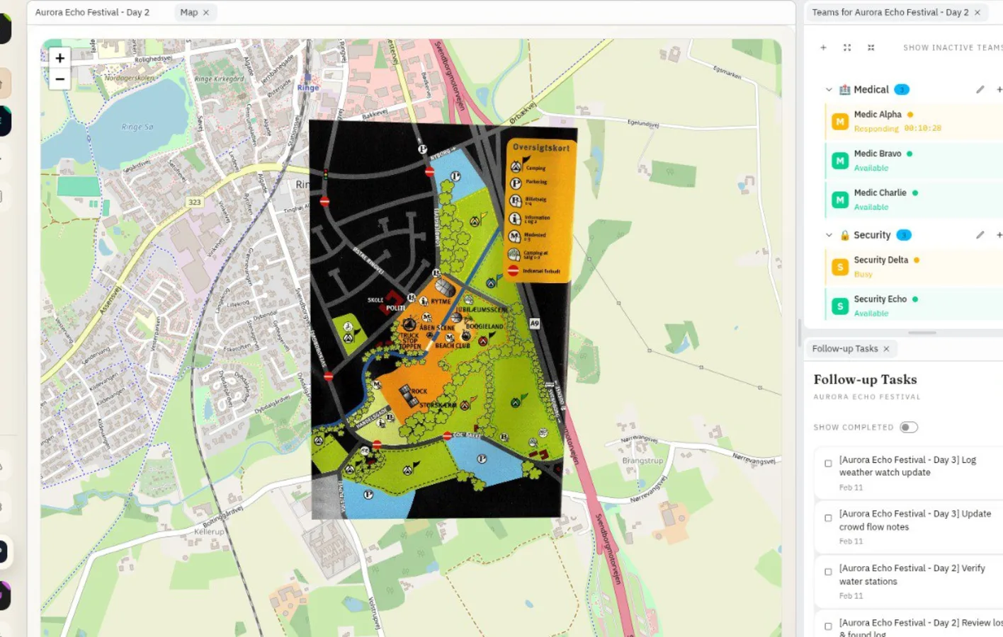
From static site drawing to live command context
Most teams already have a grid-referenced venue plan with a coordinate grid, booth layout, and safety routes.
In 2.0.0, that plan becomes a real operational base map where context is layered directly into the decision surface.
Overlay images and reference layers where they matter
Teams can place operational images and reference layers so geography, grid positions, and incident flow are visible in one glance.
This is especially useful when dispatch depends on route choice, nearby assets, or blocked access zones.
- Attach layers to exact map and grid references
- Visualize fire exits and critical paths alongside incidents
- Give command and field leads one shared geographic reference
Coordinate trust during live incidents
When teams are making fast routing decisions, confidence in map alignment matters. The site plan layer keeps everyone anchored to the same geography, coordinate grid, and naming conventions.
That means less back-and-forth about where something is, and faster action on what to do next.
- Shared coordinate-grid language across teams
- Less ambiguity on radios and handoffs
- Faster path decisions under pressure
Operational workflow from planning to dispatch
Before gates open, teams align the site plan grid with operational zones, access routes, and safety landmarks. During live hours, command overlays incident context to confirm route viability before dispatch.
After incidents, the same map context helps debrief timing and movement decisions, creating a clearer operational record for future planning.
- Pre-event alignment of map grid, layers, and zone language
- Live dispatch validation against current access paths
- Post-event map-based debrief and process refinement
Example: fire-lane access check during escalation
Security and medical teams review overlayed site-plan context before rerouting through a congested area. Command confirms nearest fire exit route and sends the updated path immediately.
- Faster dispatch in location-sensitive incidents
- Less ambiguity about safe access paths
- Cleaner post-incident map-based reconstruction
FAQ
What is a venue site plan in Shamira?
It is your event's map foundation, typically a grid-referenced map with a coordinate grid, used as a shared operational reference with coordinate-aware context.
Can we include fire exits and safety routes?
Yes. Teams can keep fire exits, safety paths, and operational zones visible in the same map-led workflow.
Is this only for GIS specialists?
No. GIS-ready teams can use precise georeferenced language, while operational teams can use familiar venue labels and route naming.
Why use overlays instead of static map screenshots?
Overlays preserve geographic context during live decision-making, so dispatch and handoff conversations reference the same source of truth.
Can teams dispatch using grid references?
Yes. Teams can align incidents and routes to the venue map's coordinate grid, which makes radio and handoff communication faster and less ambiguous.
Release History
This feature is documented in the following public release notes.
Related Product Pages
Continue your evaluation with pricing, security, and release transparency pages.